Here comes the rain
Weather - we get lots of variables, being stuck between two huge expanses of water. Story by Karen Trebilcock.
Watching the weather lately? Making balage/silage/ sowing crops/spreading nitrogen/harvesting?
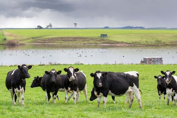
What we do as farmers is dictated by the weather and because we live on our farms, how we live is part of that.
Whether the power is going to stay on, can we get the kids to school tomorrow and will their athletics day go ahead is also all about the weather.
So checking the forecast, whether it is on your phone or watching Dan at the end of the TV news, is always part of our day. Most of us have our own weather stations as well which we can monitor from the warmth and safety of our homes.
But before trying to understand a weather forecast, you need to go one step backwards – where does that weather forecast come from?
In 1992, the New Zealand government split the then meteorological service into weather forecasting and atmospheric research.
This created the Meteorological Service of New Zealand, known as MetService, which was established as a state-owned enterprise and is New Zealand’s designated National Weather Service by the World Meteorological Organisation (WMO).
Then there is NIWA, the National Institute of Water and Atmospheric Research, which is a Crown Research Institute. NIWA went on to established NIWA Weather in 2013 which also does weather forecasting.
Yep, that’s right. Your taxes are funding two government weather forecasting services. It’s kind of like having two police forces which, they would argue, makes you so much safer in this case from floods, heavy snow and droughts.
If you don’t like government controlling your take on the weather, you can always go private and there are a few independent weather forecasting businesses as well.
So why don’t MetService and NIWA and whoever else always agree what the weather will do? And why do they sometimes get it wrong?
It’s partly because there are many global weather models each with their own prediction for what will happen.
One is the United Kingdom’s Met Office. The Brits, clever people (excusing their recent Tory politics), only have one government weather forecaster and it’s been around since 1854 when Vice-Admiral Robert Fitzroy, captain of HMS Beagle, got annoyed because he didn’t know where the storms were at sea.
Its original purpose was marine climatology because keeping people, and more importantly trade, safe at sea back then was important for the British economy.
Then there is the ECMWF, or the European Centre for Medium-Range Weather Forecasts, which boasts it has one of the largest supercomputer facilities and meteorological data archives in the world.
It’s been around since 1975 and is an “independent intergovernmental organisation”, whatever that means.
Of course, the United States also has to have one and it’s called the United States’ National Weather Service (NWS) which produces the Global Forecast System. The NWS is part of the US federal government and started out as the United States Weather Bureau in 1890.
All three models take data from everything from thermometers to satellites, interpret it using thousands of forecasters and then this is shared globally with various weather agencies including our two, which add their own expertise and interpretation to deliver the most likely forecast to you.
What could possibly go wrong?
When your phone is showing a different forecast to Dan, it’s probably because it’s using different international models.
Sometimes these international models agree on NZ’s weather but sometimes they prefer to disagree and then our forecasters will send up weather balloons and try to figure it out themselves.
As with anything, weather comes with lots of jargon. There are things called cyclones with the bad ones known as tropical cyclones (also called hurricanes or typhoons depending on where you live in the world).
Cyclones are depressions, so called because they are made up of low pressure areas, known as lows. They usually bring cloudier and wetter weather.
Anticyclones are highs which give us stable, fine weather with blue skies.
If a high or low are really big they can block smaller, oncoming highs and lows meaning sunshine, or rain, for days. The isobars show us where the highs and the lows are and the pressure changing between the two. They’re a bit like the gradient lines on a map.
The closer the isobars are to one another the more wind is created.
The wind blows along the isobars with the flow for us clockwise around lows and anti-clockwise around highs. In the Northern Hemisphere it’s the other way around.
But just because your farm has a large high hovering overhead, that doesn’t necessarily mean fine, calm weather for making hay.
There are onshore and offshore breezes due to the land and the sea being at different temperatures at different times of the day.
Rising heat from the land can cause clouds to build and cause rain plus there are lots of other variables mainly due to our country being a narrow sliver of land between the Tasman Sea and the largest ocean in the world.
Thunderstorms and their associated crop-damaging hail, as well as tropical cyclones are the hardest to forecast their exact impact areas. They also affect us the most. To keep us safe, MetService introduced colour coded weather warnings in May 2019 and the first one was the Canterbury flooding in May and June the following year. Since then, there have been eight MetService Red Warnings with local and regional states of emergencies declared.
Lots of countries do colour-coded weather warnings and in NZ they happen when the weather looks scary for a particular region in consultation with the National Emergency Management Agency and the regional councils in the affected area.
Because 100mm of rain in Fiordland is a normal day but 100mm of rain in Rangiora could cause problems, especially if there was 100mm the day before, it’s not just about the weather on the way, but how a community can handle it.
Severe weather is either heavy rain, strong wind, thunderstorms or heavy snow and a yellow watch means the forecasters are concerned that the area will get bad weather in the next few days so stay alert and keep an eye on the warnings.
An orange warning means warning criteria have been met. For example, 100mm in 24 hours, winds gusting more than 110km/h.
A MetService red warning is the most impactful weather we can get and you should be prepared for a State of Emergency being declared.
MetService aims to give these warnings at least 12 hours or more before the weather arrives giving us time to shift stock, make sure the barbie has gas and the flapping iron on the milk room roof is finally fixed.
But, as always, don’t rely completely on the forecast. When the sky looks odd, the wind is starting to build when it wasn’t predicted to and you have that feeling that something is not right then act to protect yourself, your family, staff and stock.
Have a plan for if you need to evacuate, and enough food, water and other essential supplies if you can’t. Listen to your local authorities. Make sure your insurance policies are up-to-date so your business can survive whatever happens.
And keep smiling. At least the weather in NZ is never boring.